This particular blog post covers different structural aspects of the sites of Pikillacta and Thamugadi (Timgad) and how the regions' layouts reflect their political and societal values.
Pikillacta
served as a major administrative node in the Wari Empire, most likely as a
provincial or regional capital. Like Thamugadi (Timgad), Pikillacta was also
set up in a rigid, grid-like manner and furthermore the NE side of the site is
higher in elevation than the SW side, and the ground rises and falls throughout
the site. This I assume was for defensive purposes: like what we see at the
citadel at Tiryns, Greece, where one side is higher to allow for a lookout, Pikillacta
also follows a similar structural setup. Having the one side higher allows for
Pikillacta’s inhabitants to have a better view of its attacker, and also it has
a social hierarchy because being higher up is a sign of dominance, and was
especially so at that time.


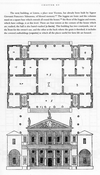
[Fig. 1] - Plan of Timgad [Fig. 2] - Plan of Pikillacta

[Fig. 3] - Aerial view of Timgad
Additionally, since Timgad and Pikillacta were set up in an
orthogonal grid-like manner (as we see in [Fig. 1] and [Fig. 2]), they were pre-planned sites, as
opposed to being more organic like at Rome for example which was organized in a more random manner. Later we see Rome’s
colonies being more organized. Rome also expanded more because it became more
socially strong, similar to at Timgad because the site, according to later
excavations expanded itself. Also like what we see in Greece, Pikillacta has
massive walls that are very constricting and it also only has two routes that
approach the site. This might imply that the Wari Empire at that time wanted to
maintain control over its occupants.

[Fig. 4] - Walls within Pikillacta Complex
The confinement of the walls (as seen in [Fig. 4]) also allowed a certain processional flow in which occupants would have to travel in certain directions throughout the complex because of the way the structures were situated. Thus, this is another implication that the structures at Pikillacta induced certain social hierarchies between the occupants and those ruling over them. Timgad, as we can see in [Fig. 4], had several entrances to the site, which also might imply that their military program was more advanced than at somewhere like Pikillacta because it had more areas to defend and thus it might have been more advanced in terms of defence.
Bibliography:
McEwan, Gordon
F. “Archeological Investigations at Pikillacta: A Wari Site in Peru.” Journal of Field Archeology 23, no. 2
(1996): 169-186.