Thursday, 18 April 2013

FDR Memorial

I took a virtual tour of the FDR Memorial through "A View on Cities" which described the Memorial in great detail and also included historical ties of the time because Americans always see the importance of their history and honouring their presidents they had the utmost respect for.
After looking at so many grid plans and urban settlements it is refreshing to look at how monuments in commemoration of a leader are erected.

The memorial statue's enormity really enhances the feeling of admiration for Roosevelt because we take him to be a powerful man. He is an important symbol of American identity and although before his passing he said he only wanted a small and modest memorial, he obviously knew that it is human nature for people to do the exact opposite of what you tell them to, hence why such a large monument was made in his honour.

Furthermore, in a review of Margaret Farrar's essay on "Building the Body Politic: Power and Urban Space in Washington, D.C., it outlines her discussion on how urban spaces are ultimately influenced by politics and also influence politics themselves. The way monuments and government buildings are erected are all representative of the politics in society, and furthermore, monuments are constructed to show power. Unless government is low on funding they are going to construct monuments and buildings to show their position and their superiority in society. Going back to the FDR Memorial, this monument was most likely constructed to show other countries America's pride for their leaders. When people gather to honour their leaders it shows them as being a healthy members of society and healthy members of society mean a healthy nation. Thus, the way politics are run in a nation ultimately dictate how urban forms are built and how structures are developed.

References:


A View on Cities: Franklin D. Roosevelt Memorial 
http://www.aviewoncities.com/washington/franklindrooseveltmemorial.htm


Review on Margaret Farrar's Essay: "Building the Body Politic: Power and Urban Space in Washington, D.C
http://www.press.uillinois.edu/books/catalog/66bfm6pd9780252032271.html


Laws of the Indies

From the Laws of the Indies (1573), it is easy to decipher the purpose of such an extensive set of conditions. After conquering many regions of the Americas, the Spanish wanted to establish how to go about founding new cities. They wanted to maintain control over these regions for their own use essentially. It's as if the Spanish were a very powerful and resourceful patron making people build based on the Spanish's rules. Very clever. The 148 ordinances also influenced how politics and social order were to be conducted.

Furthermore, as we discussed in last week's post on Granada and Santa Fe de Granada, the latter was built based on a grid-plan. Ultimately, the Spanish influenced this because they were the ones who conquered Granada in the first place so they re-built it based on their terms. An important aspect is the plaza area of the regions because the most important buildings according to the laws were to be built here. That made it so that people of less importance were pushed to the outskirts of the towns; and the Spanish liked it this way because it established a social hierarchy.

Additionally, The Law of the Indies states that for the sake of the beauty of a town, the buildings must be all of one type. This is just one example of how specific the laws can be, and yet like the earlier texts of Alberti's Ten Books on Architecture which is an area of study I have researched in the past, there are many flaws to this sort of outline because as much as it tells people what they should be doing, it does not give them guidelines about how they should do it.

References:

Laws of the Indies. Wikipedia.org
http://en.wikipedia.org/wiki/Laws_of_the_Indies

Wednesday, 17 April 2013

Granada vs. Santa Fe de Granada


In terms of urbanism, changes had been occurring throughout the fifteenth century due to the rise of Renaissance architecture. Thus, many new concepts were being developed and structural and organizational ideologies were challenged as a result. After the "re-conquering" of Grenada by the Spanish Catholics, the Christians built Santa Fe de Granada which was a grid-planned city. Like was mentioned in the blog from last week, the best way to show your dominance over another region is to rebuild a city; thus, the consecration of Santa Fe de Granada began.                                                                                                   
          [Fig. 1] Granada, Spain.                                     [Fig. 2] Santa Fe de Granada, Spain

After looking on Google Maps of Granada and Santa Fe de Granada it is quite evident that after the conquering of Granada by the Spanish Catholics, the new urban forms were applied when the building of Santa Fe commenced - that new building form was the grid plan. Granada, Spain is a more organic based city in terms of its organization, whereas Santa Fe is more compartmentalized, similar to a place like Timgad [Fig. 3] With this compartmentalization, it is easier to control a city because it is more organized and easier to establish where everything is in the layout, including the central area where a temple or a central plaza most likely would be setup. With a more organic and chaotically organized city, it is not as easy to keep track. Thus, the "re-conquering" of Granada allowed for the Spanish to build in a setup that gave them the most power and sense of order, through the grid plan that we see even today is the most common organization for new towns or settlements.

    [Fig. 3] Timgad, Algeria

Additionally, you can see from the aerial view of Santa Fe that it has a very fortified setup around it. Like earlier works we saw where structures were built in such a way that they could see if their enemies were approaching, for example at Tiyrns the Citadel with also only the one entranceway and the many fortified walls, Santa Fe is modelled in a similar way for defensive purposes. As I mentioned before, Santa Fe is in a grid-form layout which is significant because it gives structure and allows for a logical construction of protective walls to protect the city against invaders. All in all, it seemed appropriate for the Spanish to model their new city based on previous cities with the grid plan and fortification because this organization allowed them to maintain control over the city and prevent outsiders from taking over. The Spanish knew that what they conquered might be "re-conquered" yet again.


Spanish Conquer Tenochtitlan

Looking back to the Pre-Contact class I remember there being structures that certain rulers would destroy and build over as a sign of dominance and as a symbol of the new order. When these rulers would build colonial centres over the cities it was their attempt to claim authority over the new center. How else can one effectively take over? The Spanish were also prone to such activities, and in particular they took control over one of the most powerful and well known cities in all of Mesoamerica: Tenochtitlan. This being the capital of the Aztecs, in the sixteenth century the Spanish came in and thought that the picture glyphs and narratives in the books that the Aztecs created as a symbol of their town. Not only were the illustrations of their town destroyed but the Spanish altered their political and ideological structures. Because the Aztecs had established one of the strongest Mesoamerican empires, it makes sense that the Spanish would invade because it was at that time the only way to establish power and to maintain that power by controlling as many areas as possible. They obviously thought that it was important to conquer this area. Considering the Plaza Mayor had nearly thirty structures it is crazy to think that the Spanish would go to such an extent to take over to build their own colonial capital, but I guess to them that was the only way to do it.

Which came first...?

Like the old causality dilemma: which came first the chicken or the egg?..A similar dilemma has been pondered and studied for many years: which came first Chichén or Tula? This long-time question has stumped many scholars, however, recently new developments have come to the surface.

Because of the major similarities between The Temple of the Warriors at Chichén Itza, and Pyramid B at Tula, when they were erected was hard to say. Researchers claim that because of the great distance between these two sites and the fact that they are so similar stylistically, that the Toltecs invaded Chichén Itza and this ultimately influenced the architecture. Later I will attempt to argue the validity of this claim and using Google Maps, I will travel to the sites to compare the two structures of Pyramid B and The Temple of the Warriors to see if I can note the visual similarities and differences between the two sites...

First of all, the colonnades in front of both of the structures are similar in that they both depict warriors set on top of columns. However, Chichén Itza has more rounded supports Additionally, there would have been a roof atop both of the colonnades, which we know from extensive research and excavation. We also know that ritualized activities took place here but we are not sure exactly what they were. Furthermore, there are cenotes, or causeways, at both sites so this might suggest a connection of water resources. The Feathered Serpent was a common theme that we saw arose out of Teotihuacan, and it is also repeated here at both regions, which might suggest that they were trading ideas, and incorporating old motifs in their structures. Because these structures are similar to those at Teotihuacan, they might have been directly influenced by them because Teotihuacan was such a large empire at that time in Mesoamerica. There are also roads that I can see lead out of both Chichén Itza and Tula based on the maps, which, although it's difficult to see might connect at other regions and those regions' main 
structures.

Pyramid B - Tula 


Temple of the Warriors - Chichén Itza

Furthermore, each of these structures also have only one entrance to them (almost appear as a pre-cursor to the later Roman style of Classical Greek architecture when they build their temples with access only from the front - just as a side note). Although both of these structures house many similarities, I don't know myself if it is enough to justify the fact that the Toltecs invaded first. Because of trade and different political factors researchers believe that it is mostly economics that tied the two regions together, and not war between them. In light of this new evidence, it would make sense because based on the large size of both regions, if one region were to invade the other, it would take years for them to assemble a structure as large as The Temple of the Warriors. If the two regions were on good terms, and trade was happening between them it would make more sense for them to be building structures that are very similar in style. Thus, I believe that it is more likely that there was a connection between them but unless it is proven that the Toltecs did in fact invade Chichén Itza for a longer period of time (several years), it would make more sense then that they were in fact connected by war and conquering and not politically or economically.  
  

Saturday, 23 March 2013

Teotihuacan: Pyramid of the Sun and Moon

In this blog post, the exploration of the Pyramid of the Sun and Moon will be further examined and discussed, with a focus on the their size and placement in relation to other structures along the Avenue of the Dead. After learning about these structures in class, they have to me become essentially the symbols of Teotihuacan and the importance of their size and even placement is relevant because it gives us an idea of what their purpose was.

                                                         
                                                        [Fig. 1 - Pyramid of the Sun]

Firstly, the Pyramid of the Sun [Fig. 1], is one of the most important monuments in Mesoamerican history. In terms of size, the pyramid was meant to echo the shape of the mountains in the background, (the fact that the shapes are so similar cannot be a coincidence.) Furthermore, the pyramid is set off of the Avenue of the Dead and according to Google Maps, it is between the Pyramid of the Moon and the Ciudadela because at this time Teotihuacan did not see the Ciudadela as being the main focus of the city. Instead, the people spread out their great monuments along the Avenue of the Dead, almost as if the trek to see these structures was an act of penance and reflection.


[Fig. 2 - Pyramid of the Moon] 

As for the Pyramid of the Moon, [Fig. 2], this structure, although being smaller than the Pyramid of the Sun, also echoes the mountains in the background. Both the Pyramid of the Sun and Moon were meant to relate to the natural landscape around them, which is important because later civilizations who were influenced by Teotihuacan also took to their building style in a naturalistic way as well.

Furthermore, the people of Teotihuacan created a great axial alignment and looking at pictures or using Google Maps even, one can see that the ruling palace at the center of the city, marks the political power at the time and also creates a cosmic diagram of the rulers being at the center. It is also important to note that although Teotihuacan influenced many later cities, such as Tikal in terms of architecture and also in terms of style amongst the rulers, it also took its layout from places like La Venta. If you view La Venta on Google Maps, you can see the strong axial alignment and pyramids with flanking, platform areas, similar to the pyramidal organization at La Venta, see [Fig. 3].


            [Fig. 3 - La Venta pyramid layout]

In closing, Teotihuacan is home to two of the most significant structures in all of Mesoamerica, and the two monuments to this day continue to baffle people because of their enormous size. The location of the Pyramid of the Sun is also relevant because certain astrological events can be viewed from its point. These two structures overall in terms of size and placement are important Mesoamerican monuments because they give us insight into the differing views on city planning and how people at that time were constructing buildings, especially where they were constructing them, and for what reasons.

Wednesday, 13 February 2013

Timgad vs. Pikillacta


This particular blog post covers different structural aspects of the sites of Pikillacta and Thamugadi (Timgad) and how the regions' layouts reflect their political and societal values.

Pikillacta served as a major administrative node in the Wari Empire, most likely as a provincial or regional capital. Like Thamugadi (Timgad), Pikillacta was also set up in a rigid, grid-like manner and furthermore the NE side of the site is higher in elevation than the SW side, and the ground rises and falls throughout the site. This I assume was for defensive purposes: like what we see at the citadel at Tiryns, Greece, where one side is higher to allow for a lookout, Pikillacta also follows a similar structural setup. Having the one side higher allows for Pikillacta’s inhabitants to have a better view of its attacker, and also it has a social hierarchy because being higher up is a sign of dominance, and was especially so at that time. 


                                  [Fig. 1] - Plan of Timgad                           [Fig. 2] - Plan of Pikillacta 


[Fig. 3] - Aerial view of Timgad 

Additionally, since Timgad and Pikillacta were set up in an orthogonal grid-like manner (as we see in [Fig. 1] and [Fig. 2]), they were pre-planned sites, as opposed to being more organic like at Rome for example which was organized in a more random manner. Later we see Rome’s colonies being more organized. Rome also expanded more because it became more socially strong, similar to at Timgad because the site, according to later excavations expanded itself. Also like what we see in Greece, Pikillacta has massive walls that are very constricting and it also only has two routes that approach the site. This might imply that the Wari Empire at that time wanted to maintain control over its occupants. 

                                        
                                                   [Fig. 4] - Walls within Pikillacta Complex


The confinement of the walls (as seen in [Fig. 4]) also allowed a certain processional flow in which occupants would have to travel in certain directions throughout the complex because of the way the structures were situated. Thus, this is another implication that the structures at Pikillacta induced certain social hierarchies between the occupants and those ruling over them. Timgad, as we can see in [Fig. 4], had several entrances to the site, which also might imply that their military program was more advanced than at somewhere like Pikillacta because it had more areas to defend and thus it might have been more advanced in terms of defence. 

Bibliography:

McEwan, Gordon F. “Archeological Investigations at Pikillacta: A Wari Site in Peru.” Journal of Field Archeology 23, no. 2 (1996): 169-186. 


Libre delle case...


This particular blog post focuses on a particular aspect of Rome and Roman buildings: Archival books documenting information on structure and the structures' history.

Roman institutions since the mid sixteenth century have kept inventories of buildings produced by the pious institutions of Rome including hospitals, and convents, which are based on initial plans, and later elevations to the structures. These inventories are referred to as the libre delle case. The introduction of these plans document a fundamental change in how the city of Rome was understood - it was thus far seen more as a continuous spatial field. 

At a time when real estate market was booming, these documents were very informative and gave a sense of the function of the building and even those who rented the buildings. These inscriptions along with the plans made the book like a mini archive. Later in the eighteenth-century, the book, also known as the house book of the Annunziata achieved an even greater appreciation because the "visual" plans allowed for easier categorization of structures in Rome. 


A particularly interesting Roman building is the Villa Valmarana at Lisiera, [Fig. 1]. This particular image is found in the text On Architecture (1570). It included relevant information including dimensions of the building on a separate page, and the actual building plan. 


The appearance of the house plans was very beneficial especially with Rome's growing real estate market. With the increase in population from around 40,000 in 1513 to 122,000 in 1655, and the fact that most people lived in rented accommodations, the house books transformed the way property was being leased because at that time. 

In conclusion, these house books were not only informative in terms of the buildings' aspects, they were also considered real estate catalogues. They give a description of the physical forms of the buildings, rental history, and payment of rent. This greater detail reflects the importance of the houses and it is also part of a general systematization of the administration of the institutions.

Bibliography

Friedman, David. “Visual Documents, Property Archives, and the Map of the City of Rome: 1563-1712.” Journal of the Society of Architectural Historians 71, no. 3 (September 2012): 268-269. 


Monday, 28 January 2013

Introductory Blog

Dear fellow classmates,

My name is Caroline Rabideau and I am currently in my third year of an Honours Specialization degree  in Art History and Criticism. Throughout the years I have become more open to architecture and understanding its finite details and the importance of distinguishing between different regions' styles. Last term I was fortunate enough to be in Professor Barteet's Pre-Contact/Mesoamerican course, which I found absolutely fascinating seeing as I had little understanding prior to that course of the Maya and other Pre-Contact cultures. More importantly, I am extremely interested in learning more about how architecture has developed over the years and how civilizations have built on pre-existing structures both literally and also stylistically in newly erected buildings. I look forward to exploring more about Architectural Wonders in this class and discussing them with my fellow classmates!

I have posted pictures of some of my favourite structures from the Mesoamerican cultures, and some from the early structures in Greece and Rome.

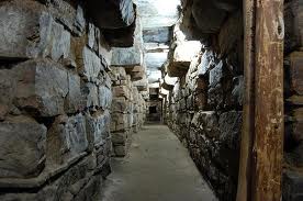
Interior of Chavin de Huantar in Peru 
*Photo courtesy of Google Images*


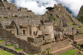
Architectural remains of Machi Picchu in Peru 
*Photo courtesy of Google Images*


Machu Picchu
*Photo courtesy of Google Images*


The Parthenon in Athens, Greece
*Photo courtesy of Google Images*


Temple of Vesta in Tivoli, Italy 
*Photo courtesy of Google Images*


Also, I am currently in the Romanesque and Gothic course; the architecture is absolutely remarkable and has inspired me to possibly partake in an exchange to Germany to engage with these structures directly over the summer. Some of my favourite Romanesque buildings I have also shared.

Speyer Cathedral in Speyer, Germany 
*Photo courtesy of Google Images*


Saint Marie Madeleine Abbey Church in Vezelay, France 
*Photo courtesy of Google Images*

Interior of Marie Madeleine Abbey Church
*Photo courtesy of Google Images*


I am very excited for this architectural journey to unfold over the next several weeks!